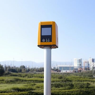
logo
منزل المنتجاتالرياح دوبلر ليدار

Vertical Range minus 10 to 190 degrees remote data collection tool featuring 4 kilometer vertical measuring distance tailored for industrial

شهادة
الصين Nanjing Movelaser Co., Ltd. الشهادات
زبون مراجعة
أنا راض جدا عن موقف خدمة ما بعد البيع، جودة المنتج ممتازة، وأتمنى أن تستمر في الحفاظ عليه

—— ليونغ شيونغ

منتجات شركتك أظهرت أداء ممتاز وجودة ممتازة أثناء التشغيلتوفير دعم قوي في سيناريوهات مثل قياس الرياح في بداية المشروع وتقييم المشروع التشغيليفريقك يوفر استجابة في الوقت المناسب، والتواصل الفعال، وخدمة مدروسة في تركيب المعدات، والصيانة.

—— (يوندا لي)

بعد أن يكتشف المنتج المشاكل ، يمكن التعامل معها بسرعة بعد البيع. يوصى بجعل المنتج مناسبًا لمزيد من البيئات。

—— جيمن فو

بشكل عام ، أنا راضٍ جدًا وآمل أن أستمر في تزويدنا بمعدات رادار أكثر تقدمًا وموثوقية واستقرارًا.

—— فان يانغ

من المأمول أن تستمر المنتجات في التحسين والتحديث والتكرار ، وستكون الجودة أكثر استقرارًا ، وستستمر الخدمة والتسليم وما بعد البيع في الحفاظ على الجودة العالية وتحقيق المستوى الرائد في الصناعة.

—— يووي وانغ

تسليم المنتج ، تجهيز المعدات في الوقت المناسب جدا

—— لونغ تشن

الموقف الإيجابي لموظفي التسويق ، خدمة ما بعد البيع في الوقت المناسب

—— كاي تشاو

استمر في العمل الجاد والتعاون المربح للجانبين

—— يويان شيه

المعدات والخدمة جيدة جدًا ، وأتطلع إلى استمرار التعاون في المستقبل.

—— مينجي تشو

الجهاز سهل التركيب ومناسب لاختبار الوحدة.

—— لوك وانج

يتمتع ليدار الرياح الأرضي بأداء جيد وقد تم الاعتراف به من قبل مصنعي الماكينات الداخليين والكامل ، ولا يوجد اعتراض على نتائج الاختبار. يتمتع موظفو المبيعات بمعرفة فنية واسعة وإجابات احترافية. الموظفون في الموقع نشيطون ويتطلعون إلى التعاون مرة أخرى.

—— كونبينج لو

في خدمة تثبيت الرادار ، يتمتع موظفو التسويق بموقف جيد وقدرة تقنية قوية وحل المشكلات القائمة ، مما يوفر ضمانًا قويًا لنقل وتركيب الليدار.

—— ليانغ جاو

هذا النظام قياس الرياح قد تحول تماما جمع البيانات لدينا. الدقة والاستقرار متميزة، حتى في الظروف القاسية.فريق الدعم الفني محترف للغاية!

—— (جيمس إم)

منذ نشر أجهزة LiDAR الخاصة بك، زادت كفاءة تقييم مزرعة الرياح لدينا بما لا يقل عن 40٪. إنه ليس موثوقًا به فحسب، بل سهل الاستخدام أيضًا. موصى به بشدة لأي شخص في هذا المجال!

—— صوفيا تشين

دقة فائقة ومتانة لا تصدق! تعتمد محطاتنا الميدانية على هذه المعدات على المدى الطويل، ولم تخذلنا أبدًا. مزيج مثالي من التكنولوجيا المتطورة والتصميم العملي.

—— أحمد الفارسي

كباحث، أطلب أعلى دقة للبيانات. لقد تجاوز هذا النظام جميع التوقعات، فقد أدى استهلاك الطاقة المنخفض وسهولة التكامل إلى تسريع مشروعنا بشكل كبير.

—— (إيلينا روسي)

مستقر ودقيق وخالٍ تقريبًا من الصيانة - بالضبط الحل الصناعي الذي كنا نحتاجه. لقد ساعدنا في تحسين إنتاج الطاقة مع تقليل تكاليف التشغيل بشكل كبير.

—— توماس هيريرا

من الاستشارات السابقة للبيع إلى التدريب الفني، كانت تجربة الخدمة لا تشوبها شائبة. الأجهزة تعمل بشكل ممتاز وتوفر رؤى حاسمة لمشاريع طاقة الرياح لعملائنا.

—— بريا شارما

لقد اختبرنا العديد من المنتجات المماثلة، ولكن هذا النظام يبرز لاستقرارها على المدى الطويل وتناسق البيانات.

—— (بيورن لوندغرين)

ابن دردش الآن

Vertical Range minus 10 to 190 degrees remote data collection tool featuring 4 kilometer vertical measuring distance tailored for industrial

Vertical Range minus 10 to 190 degrees remote data collection tool featuring 4 kilometer vertical measuring distance tailored for industrial

صورة كبيرة :  Vertical Range minus 10 to 190 degrees remote data collection tool featuring 4 kilometer vertical measuring distance tailored for industrial

تفاصيل المنتج:
اسم العلامة التجارية: MOVELASER
Model Number: 3D Scanning Doppler Wind Lidar Molas 3D
شروط الدفع والشحن:
Minimum Order Quantity: 1 Set
Packaging Details: Air Box
Delivery Time: 1-2 Months
Payment Terms: L/C, D/A, D/P, T/T
Supply Ability: 200 Set ,1 Month
مفصلة وصف المنتج
Size: 756mm*735mm*1000mm Sight Detection Distance: 10km
Maximum Acquisition Distance: 15km Distance Resolution: 15m/30m/75m/120m
Sight Wind Speed Accuracy: 0.1m/s Weight: ≤100kg
Pointing Acuracy: ±0.005° DataStorage Time: 5to18months
إبراز:

Doppler Wind Lidar remote data collection,Doppler Wind Lidar 4km measuring distance,Doppler Wind Lidar industrial vertical range

,

Doppler Wind Lidar 4km measuring distance

,

Doppler Wind Lidar industrial vertical range

Product Description:

Molas 3D is an advanced Doppler wind measurement lidar that operates using three-dimensional scanning technology. It utilizes the principle of pulsed laser coherent Doppler frequency shift to accurately capture wind speed data.

This innovative device supports multiple scanning modes, including P-Pl, RHI, DBS, and program scanning. Such versatility allows it to be tailored for specific wind speed measurement requirements across various applications.

The Molas 3D lidar is well-suited for a wide range of customized scenarios. These include offshore wind resource assessment, research in complex terrains, wind turbine wake detection, and airport glide path wind shear warnings. Additionally, it is valuable for urban meteorological observations and detecting high-altitude turbulence.


Features:

Comprehensive Measurement Capabilities

The system offers detailed measurement information by utilizing a refined 3D wind field measurement technique. It supports up to 300 customizable distance layers, allowing for precise and tailored data acquisition.

Wide Detection Range

Equipped with a large detection range, the device can monitor sight distances up to 10 kilometers, particularly effective at altitudes below 600 meters.

High Accuracy Performance

This technology ensures exceptional precision, featuring a pointing accuracy of 0.005 degrees and a visual direction wind speed accuracy of 0.1 meters per second.

Diverse Scanning Methods

Multiple scanning techniques are supported, including PPl, RHl, DBS, and a programmable arbitrary scan method, allowing for versatile operational modes based on varying measurement needs.

Flexible and Lightweight Deployment

Designed to be small and lightweight, the system facilitates easy transportation and rapid deployment in different environments.

All-Weather Durability

Built to withstand harsh outdoor environments, it offers survivability in LPz0 and features lightning protection zones, ensuring reliable operation regardless of weather conditions.

Safety and Security Features

Safety is paramount, with integrated GPS location reporting and geo-fencing capabilities. Additionally, data encryption safeguards against any risk of information leakage.

Multiple Configuration Options

Users can select from four distance resolutions and five accumulation times, providing flexibility to tailor the system’s operation to specific requirements.


Technical Parameters:

Vertical Range -10~190°
Sight Detection Distance 10 km
Sight Wind Speed Range -75~+75 m/s
Distance Resolution 15 m / 30 m / 75 m / 120 m
Sight Wind Speed Accuracy 0.1 m/s
Distance Layers Up to 300
Pointing Accuracy ±0.005°
Accumulation Time 0.2~10 s (Optional)
Data Storage Time 5 to 18 months
Vertical Measuring Distance 4 km

Applications:

Wind resource assessment involves collecting wind field data over extensive areas, which helps to minimize the risks associated with site selection for wind energy projects. By accurately measuring wind parameters, it ensures better planning and utilization of wind resources.

Long-distance power curve measurements and wake eddy current assessments play a significant role in optimizing wind energy utilization. These measurements contribute to improving the efficiency of wind energy units by providing detailed insights into wind flow dynamics and turbine performance.

Early detection and warning systems are essential for identifying dangerous meteorological phenomena, such as wind shear and microbursts. Timely warnings can enhance safety measures in aviation and other weather-sensitive operations.

Measuring wake vortices is crucial for optimizing flight separation at airports. By understanding these vortices, air traffic controllers can better manage aircraft spacing, thereby increasing airport traffic efficiency and safety.

Providing detailed wind field information aids in understanding the behavior of wind within the atmospheric boundary layer. This data is vital for meteorological studies and improving weather forecasting models.

Accurate and high spatiotemporal wind profile measurements near the surface, within a few kilometers, help fill the observation gaps at low altitudes. This enhanced data resolution supports various applications ranging from environmental monitoring to renewable energy development.

Real-time three-dimensional information about plume dispersion enables effective tracking of emission sources. Such monitoring is particularly valuable for environmental management and controlling air pollution.

Additionally, optimizing dust emission control in the mining industry relies on precise wind and dispersion measurements. These techniques help minimize environmental impacts and enhance operational safety in mining activities.


تفاصيل الاتصال
Nanjing Movelaser Co., Ltd.

اتصل شخص: Miss. ivyyao

الهاتف :: +86 13072523225

الفاكس: 86-025-86800073

إرسال استفسارك مباشرة لنا (0 / 3000)

منتجات أخرى