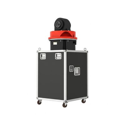
logo
منزل المنتجاتالرياح دوبلر ليدار

Scanning Method PPI RHI DBS And Program Scan Doppler Wind Lidar With Pointing Accuracy ±0.005 Degrees And Dimensions 756mm 735mm 1000mm

شهادة
الصين Nanjing Movelaser Co., Ltd. الشهادات
زبون مراجعة
أنا راض جدا عن موقف خدمة ما بعد البيع، جودة المنتج ممتازة، وأتمنى أن تستمر في الحفاظ عليه

—— ليونغ شيونغ

منتجات شركتك أظهرت أداء ممتاز وجودة ممتازة أثناء التشغيلتوفير دعم قوي في سيناريوهات مثل قياس الرياح في بداية المشروع وتقييم المشروع التشغيليفريقك يوفر استجابة في الوقت المناسب، والتواصل الفعال، وخدمة مدروسة في تركيب المعدات، والصيانة.

—— (يوندا لي)

بعد أن يكتشف المنتج المشاكل ، يمكن التعامل معها بسرعة بعد البيع. يوصى بجعل المنتج مناسبًا لمزيد من البيئات。

—— جيمن فو

بشكل عام ، أنا راضٍ جدًا وآمل أن أستمر في تزويدنا بمعدات رادار أكثر تقدمًا وموثوقية واستقرارًا.

—— فان يانغ

من المأمول أن تستمر المنتجات في التحسين والتحديث والتكرار ، وستكون الجودة أكثر استقرارًا ، وستستمر الخدمة والتسليم وما بعد البيع في الحفاظ على الجودة العالية وتحقيق المستوى الرائد في الصناعة.

—— يووي وانغ

تسليم المنتج ، تجهيز المعدات في الوقت المناسب جدا

—— لونغ تشن

الموقف الإيجابي لموظفي التسويق ، خدمة ما بعد البيع في الوقت المناسب

—— كاي تشاو

استمر في العمل الجاد والتعاون المربح للجانبين

—— يويان شيه

المعدات والخدمة جيدة جدًا ، وأتطلع إلى استمرار التعاون في المستقبل.

—— مينجي تشو

الجهاز سهل التركيب ومناسب لاختبار الوحدة.

—— لوك وانج

يتمتع ليدار الرياح الأرضي بأداء جيد وقد تم الاعتراف به من قبل مصنعي الماكينات الداخليين والكامل ، ولا يوجد اعتراض على نتائج الاختبار. يتمتع موظفو المبيعات بمعرفة فنية واسعة وإجابات احترافية. الموظفون في الموقع نشيطون ويتطلعون إلى التعاون مرة أخرى.

—— كونبينج لو

في خدمة تثبيت الرادار ، يتمتع موظفو التسويق بموقف جيد وقدرة تقنية قوية وحل المشكلات القائمة ، مما يوفر ضمانًا قويًا لنقل وتركيب الليدار.

—— ليانغ جاو

هذا النظام قياس الرياح قد تحول تماما جمع البيانات لدينا. الدقة والاستقرار متميزة، حتى في الظروف القاسية.فريق الدعم الفني محترف للغاية!

—— (جيمس إم)

منذ نشر أجهزة LiDAR الخاصة بك، زادت كفاءة تقييم مزرعة الرياح لدينا بما لا يقل عن 40٪. إنه ليس موثوقًا به فحسب، بل سهل الاستخدام أيضًا. موصى به بشدة لأي شخص في هذا المجال!

—— صوفيا تشين

دقة فائقة ومتانة لا تصدق! تعتمد محطاتنا الميدانية على هذه المعدات على المدى الطويل، ولم تخذلنا أبدًا. مزيج مثالي من التكنولوجيا المتطورة والتصميم العملي.

—— أحمد الفارسي

كباحث، أطلب أعلى دقة للبيانات. لقد تجاوز هذا النظام جميع التوقعات، فقد أدى استهلاك الطاقة المنخفض وسهولة التكامل إلى تسريع مشروعنا بشكل كبير.

—— (إيلينا روسي)

مستقر ودقيق وخالٍ تقريبًا من الصيانة - بالضبط الحل الصناعي الذي كنا نحتاجه. لقد ساعدنا في تحسين إنتاج الطاقة مع تقليل تكاليف التشغيل بشكل كبير.

—— توماس هيريرا

من الاستشارات السابقة للبيع إلى التدريب الفني، كانت تجربة الخدمة لا تشوبها شائبة. الأجهزة تعمل بشكل ممتاز وتوفر رؤى حاسمة لمشاريع طاقة الرياح لعملائنا.

—— بريا شارما

لقد اختبرنا العديد من المنتجات المماثلة، ولكن هذا النظام يبرز لاستقرارها على المدى الطويل وتناسق البيانات.

—— (بيورن لوندغرين)

ابن دردش الآن

Scanning Method PPI RHI DBS And Program Scan Doppler Wind Lidar With Pointing Accuracy ±0.005 Degrees And Dimensions 756mm 735mm 1000mm

Scanning Method PPI RHI DBS And Program Scan Doppler Wind Lidar With Pointing Accuracy ±0.005 Degrees And Dimensions 756mm 735mm 1000mm

صورة كبيرة :  Scanning Method PPI RHI DBS And Program Scan Doppler Wind Lidar With Pointing Accuracy ±0.005 Degrees And Dimensions 756mm 735mm 1000mm

تفاصيل المنتج:
اسم العلامة التجارية: MOVELASER
Model Number: 3D Scanning Doppler Wind Lidar Molas 3D
شروط الدفع والشحن:
Minimum Order Quantity: 1 Set
Packaging Details: Air Box
Delivery Time: 1-2 Months
Payment Terms: L/C, D/A, D/P, T/T
Supply Ability: 200 Set ,1 Month
مفصلة وصف المنتج
Sight Wind Speed Accuracy: 0.1m/s Maximum Acquisition Distance: 15km
Scanning Method: PPI、RHI、DBS And Program Scan DataStorage Time: 5to18months
Data Output: Profibus DP/Modbus TCP/CAN Optional Distance Layers: Up To 300
Size: 756mm*735mm*1000mm Distance Resolution: 15m/30m/75m/120m
إبراز:

Doppler Wind Lidar with PPI scanning,Doppler Wind Lidar RHI DBS scan,wind lidar with ±0.005° accuracy

,

Doppler Wind Lidar RHI DBS scan

,

wind lidar with ±0.005° accuracy

Product Description:

Molas 3D is an advanced Doppler wind measurement lidar that operates using three-dimensional scanning technology. It is based on the principle of pulsed laser coherent Doppler frequency shift, enabling precise detection of wind characteristics.

This system supports multiple scanning modes including P-Pl, RHl, DBS, and program scanning. These versatile modes allow for flexible and customized wind speed measurement tailored to various needs.

Molas 3D is suitable for a wide range of applications. It can be used for offshore wind resource assessment, research in complex terrain environments, and detection of wind turbine wake effects. Additionally, it plays a critical role in airport glide path wind shear warnings, urban meteorological observations, and high-altitude turbulence detection.


Features:

Comprehensive Measurement Capabilities: This system offers detailed 3D wind field measurements with up to 300 customizable distance layers, ensuring highly refined data collection tailored to specific needs.

Extensive Detection Range: Equipped to detect targets up to 10 kilometers away at altitudes below 600 meters, it provides a broad scope for accurate sight detection.

Exceptional Precision: Featuring a pointing accuracy of 0.005° and a visual direction wind speed accuracy of 0.1 meters per second, it guarantees highly reliable and precise measurements.

Diverse Scanning Techniques: Supports multiple scanning methods including PPI, RHI, DBS, and programmable arbitrary scan modes, offering versatility in data acquisition.

Flexible and Lightweight Design: Its compact and lightweight construction allows for easy deployment and swift adaptation to various operational environments.

Durable in All Weather Conditions: Built to withstand harsh outdoor environments, it features survivability in LPZ0 and includes lightning protection, ensuring consistent performance regardless of the weather.

Secure and Safe Operation: Incorporates GPS location reporting and geo-fencing capabilities alongside data encryption measures to prevent any risk of information leakage.

Multiple Configuration Options: Offers four different distance resolutions and five selectable accumulation times, enabling customized settings to meet diverse operational requirements.


Technical Parameters:

Sight Detection Distance 10 km
Pointing Accuracy ±0.005°
Maximum Acquisition Distance 15 km
Weight ≤100 kg
Vertical Measuring Distance 4 km
Data Output Profibus DP / Modbus TCP / CAN Optional
Accumulation Time 0.2 ~ 10 s Optional
Sight Wind Speed Range -75 ~ +75 m/s
Vertical Range -10 ~ 190°
Scanning Method PPI, RHI, DBS and Program Scan

This ground-based Doppler wind lidar product is designed for accurate lidar measurement and is ideal for onshore wind lidar applications.


Applications:

Wind Resource Assessment

Conducting comprehensive wind resource assessments involves measuring wind field data across extensive areas. This process helps in minimizing the risks associated with site selection for wind energy projects.

Long-distance power curve measurements and wake eddy current analysis are utilized to enhance the efficient use of wind energy. These methods contribute to optimizing the performance and efficiency of wind energy units.

Detection and Early Warning of Hazardous Meteorological Phenomena

Advanced detection systems enable the early warning of dangerous weather events such as wind shear and microbursts. These insights are crucial for safety, especially in aviation and other vulnerable sectors.

Measurement of wake vortices is essential to optimize flight separation at airports, thereby improving air traffic management and safety.

Wind Field Information and Low-Altitude Observations

Providing detailed wind field information is vital for understanding the dynamics within the atmospheric boundary layer.

Accurate and high-resolution spatiotemporal wind profile data within a few kilometers of the surface address the existing gaps in low-altitude meteorological observations.

Real-Time 3D Plume Dispersion Monitoring

Real-time three-dimensional information on plume dispersion aids in tracking emission sources efficiently.

This capability is particularly valuable for optimizing dust emission control strategies in the mining industry, enhancing environmental management and compliance.


تفاصيل الاتصال
Nanjing Movelaser Co., Ltd.

اتصل شخص: Miss. ivyyao

الهاتف :: +86 13072523225

الفاكس: 86-025-86800073

إرسال استفسارك مباشرة لنا (0 / 3000)

منتجات أخرى